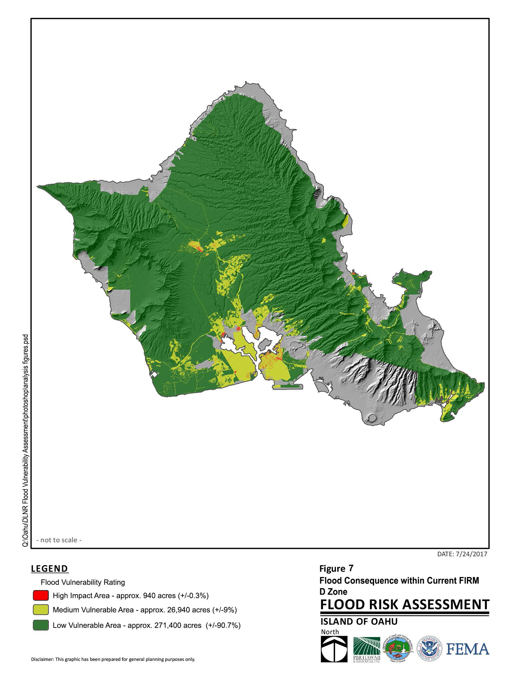
PBR HAWAII prepared the O‘ahu Island Flood Vulnerability Assessment Report and has been selected to prepare the Hawai‘i, Maui, Moloka‘i, Lāna‘i and Kaua‘i Island Flood Vulnerability Assessment Reports. These reports satisfy a technical pilot project to: 1) assess flood risk vulnerability statewide; and 2) provide the Federal Emergency Management Agency with information identifying areas that need to be mapped on the Flood Insurance Rate Maps.
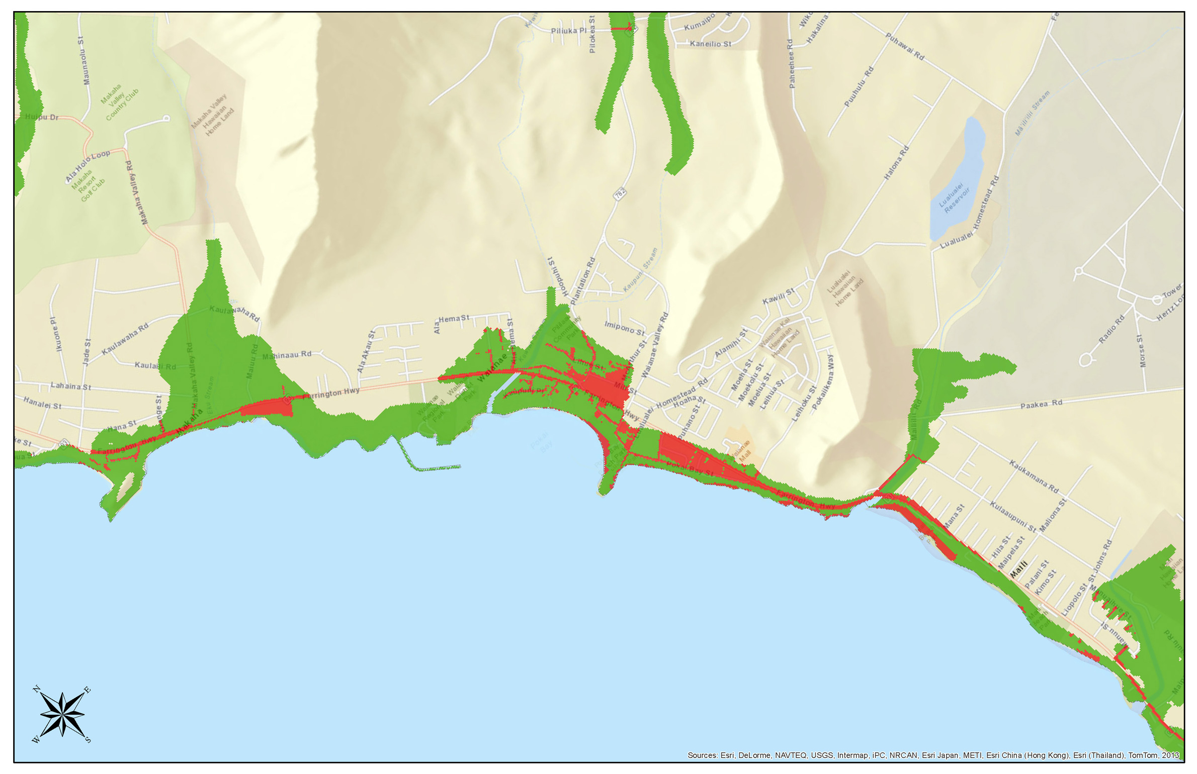
The analysis included compiling GIS data to illustrate probable flood areas and paired it with asset mapping to develop flood vulnerability maps. The resulting maps offer the State a direction in suggesting where FEMA should focus flood mapping resources.
For O‘ahu Island, PBR HAWAII prepared a building footprint layer in GIS. The flood vulnerability assessment for the islands of Hawai‘i and Maui are being done in GIS using publicly available GIS data, including a building footprint GIS layer for Maui.