PBR HAWAII prepared the O‘ahu Island Plan (OIP) for the Department of Hawaiian Home Lands (DHHL). The goal of the OIP is to provide recommendations for the future uses of DHHL’s lands on the island of O‘ahu to: 1) meet beneficiary and department needs over the next 10 years; and 2) ensure coordinated, integrated, and orderly social, physical, cultural and economic growth and development.
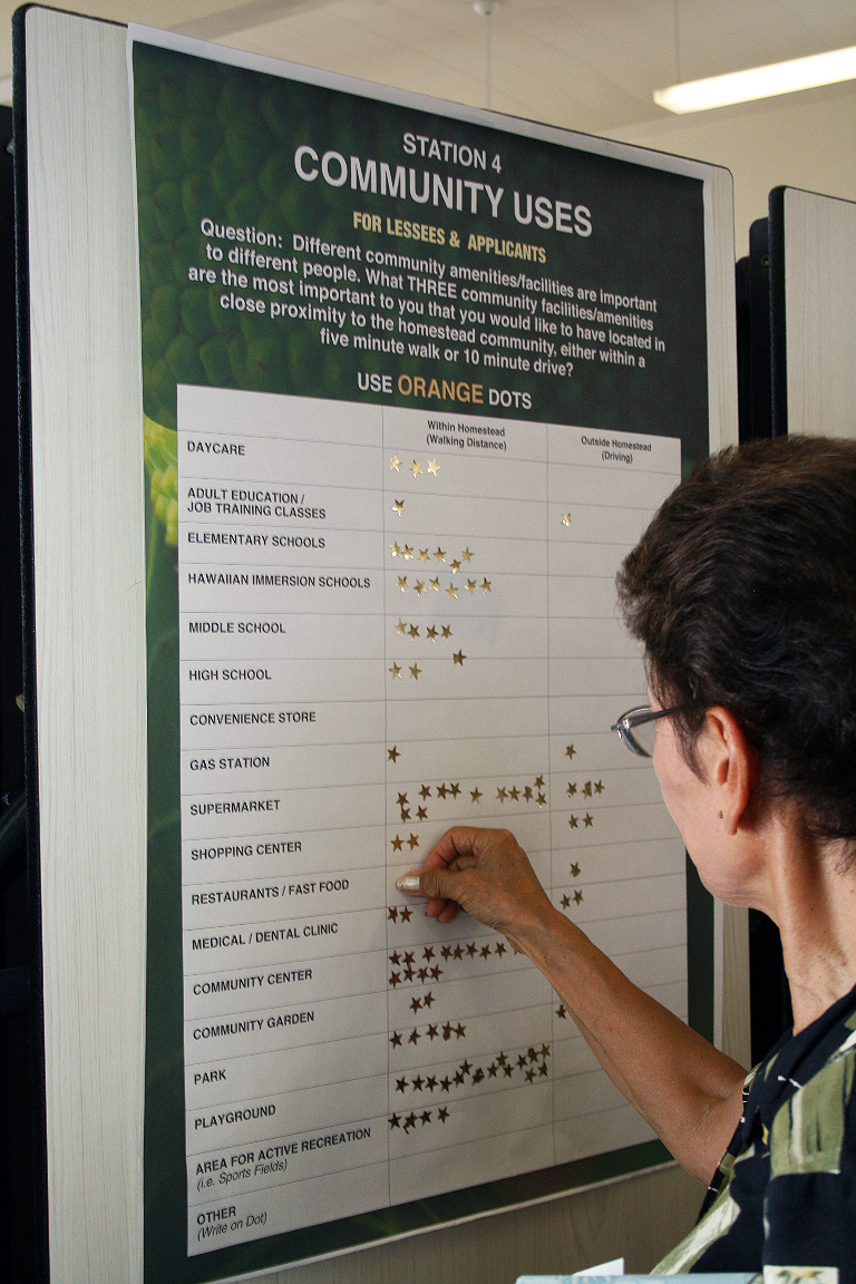
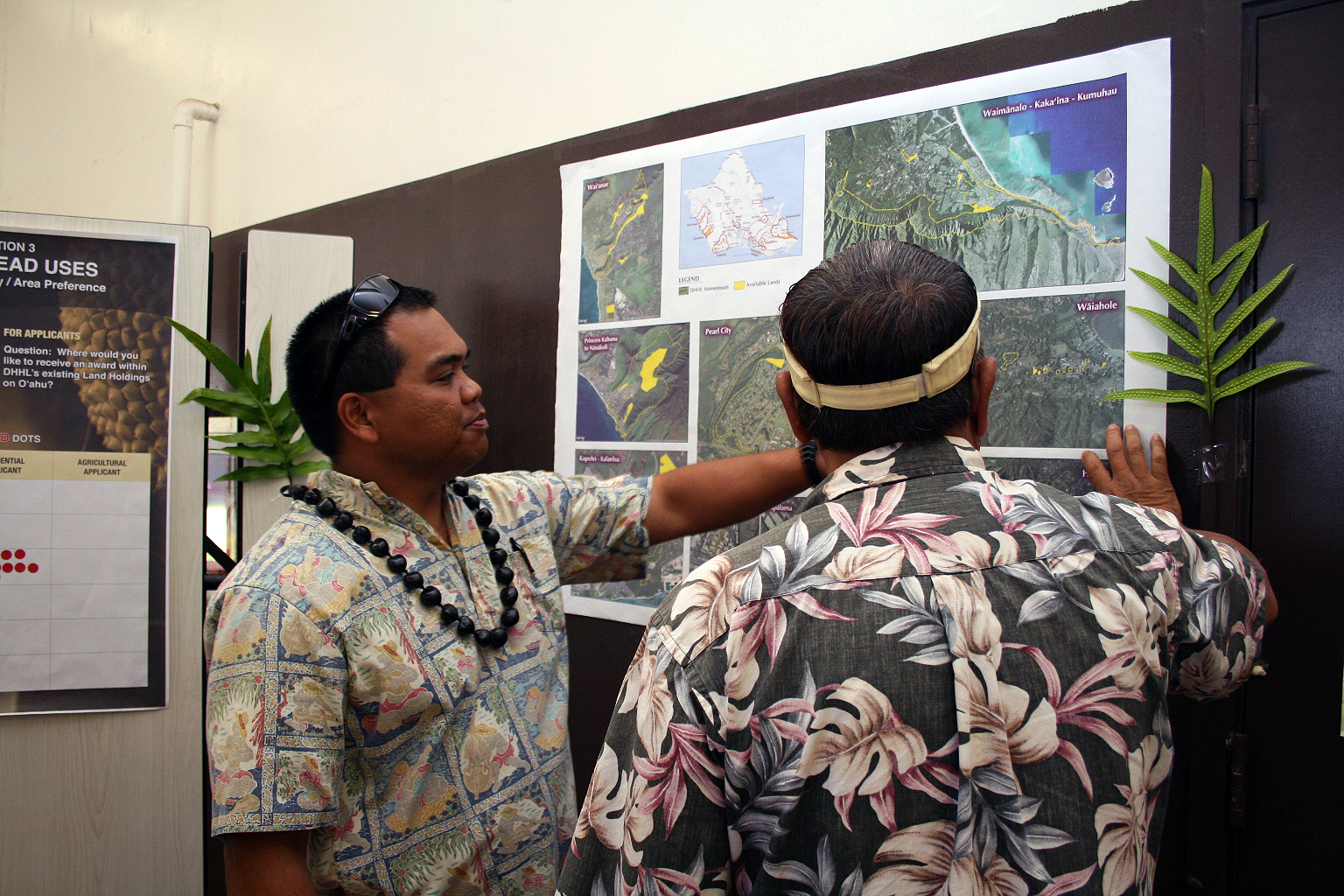
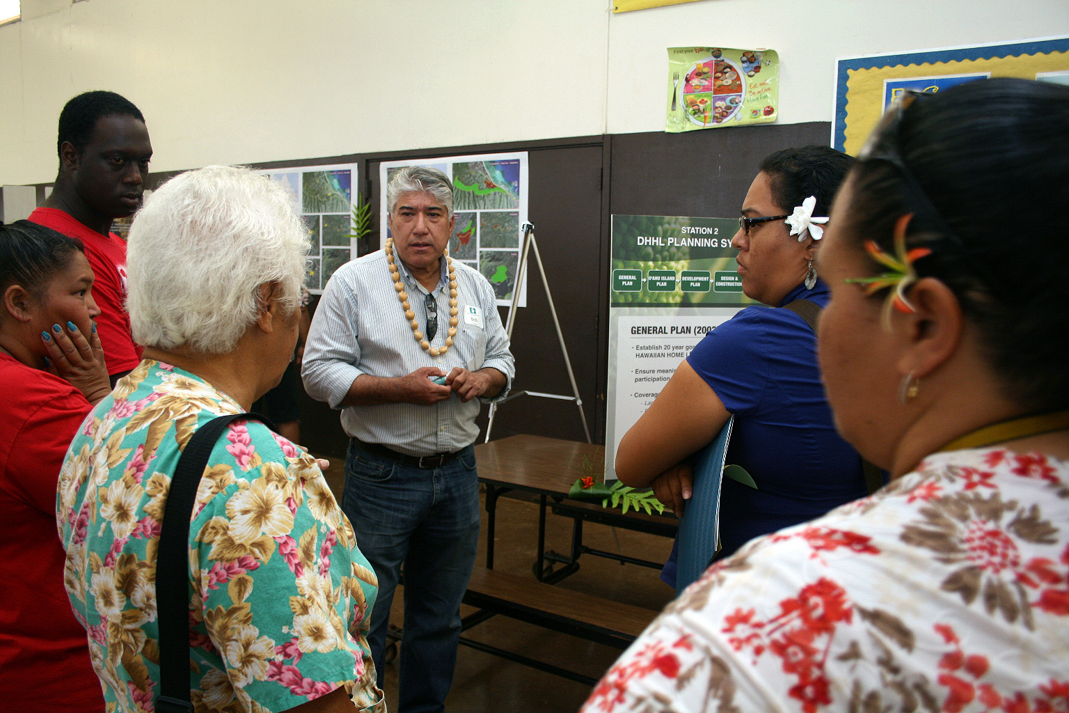
In the development of the plan, PBR HAWAII used GIS as one of the tools for: 1) developing baseline data on demographics and preferences for the location of future homestead development; 2) determining land suitability and land use designations of DHHL parcels; and 3) identifying potential land acquisition areas.
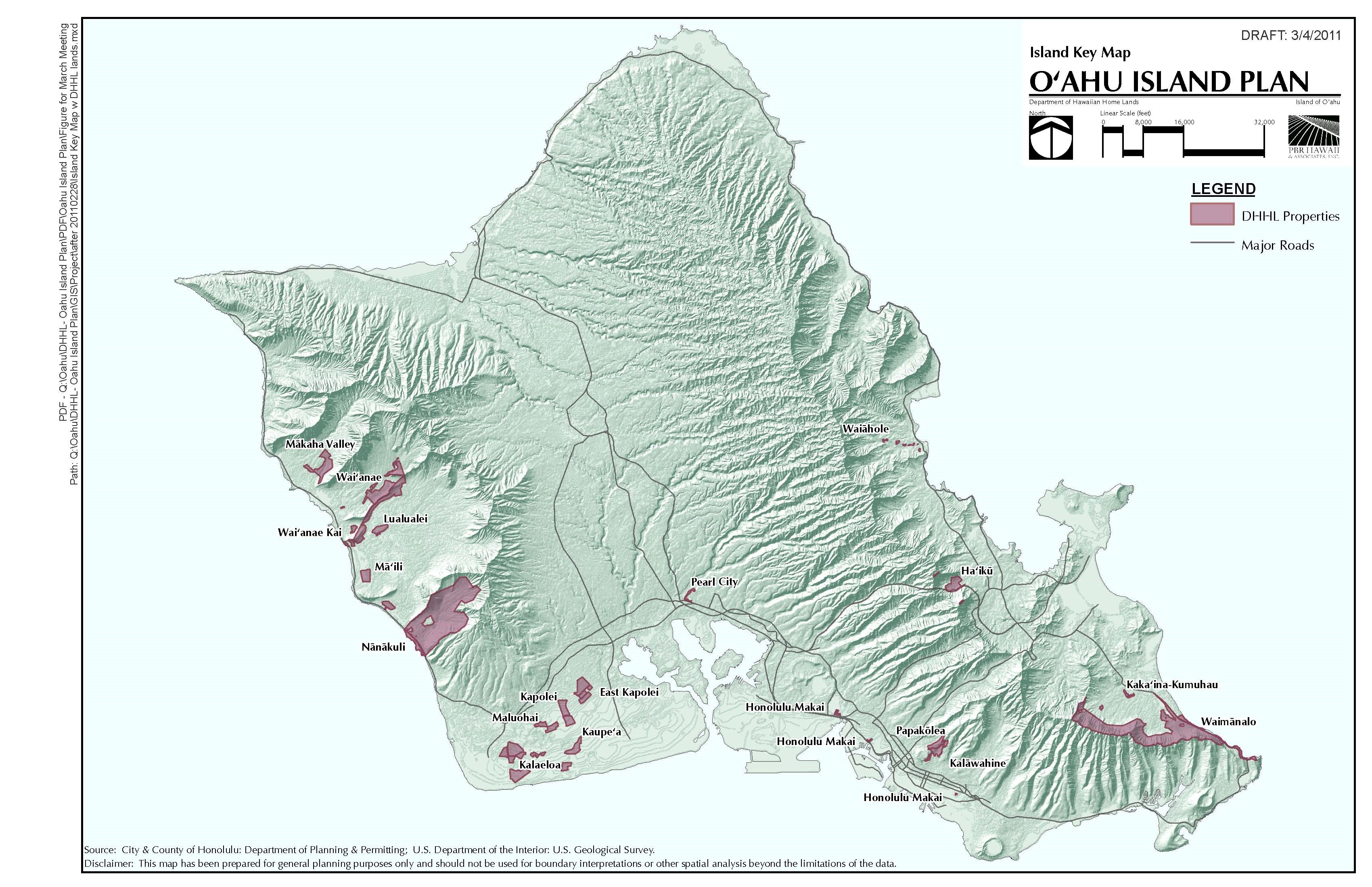
DHHL’s total land inventory on the island of O‘ahu is approximately 7,000 acres, which is comparatively small compared to the other islands. Due to the limited land holdings and the large number of applicants looking for homesteading opportunities on O‘ahu, the OIP synthesized the need for possible land acquisitions. This project was undertaken to meet Section 213(e) of the Hawaiian Homes Commission Act, authorizing planning studies to provide the basis for land use designations and appropriate land management strategies.
SERVICES
Community Outreach Land Planning
LOCATION
Island of O‘ahu
YEAR
2014
AWARDS
2015 American Planning Association, Hawai‘i Chapter, Community-Based Planning Award