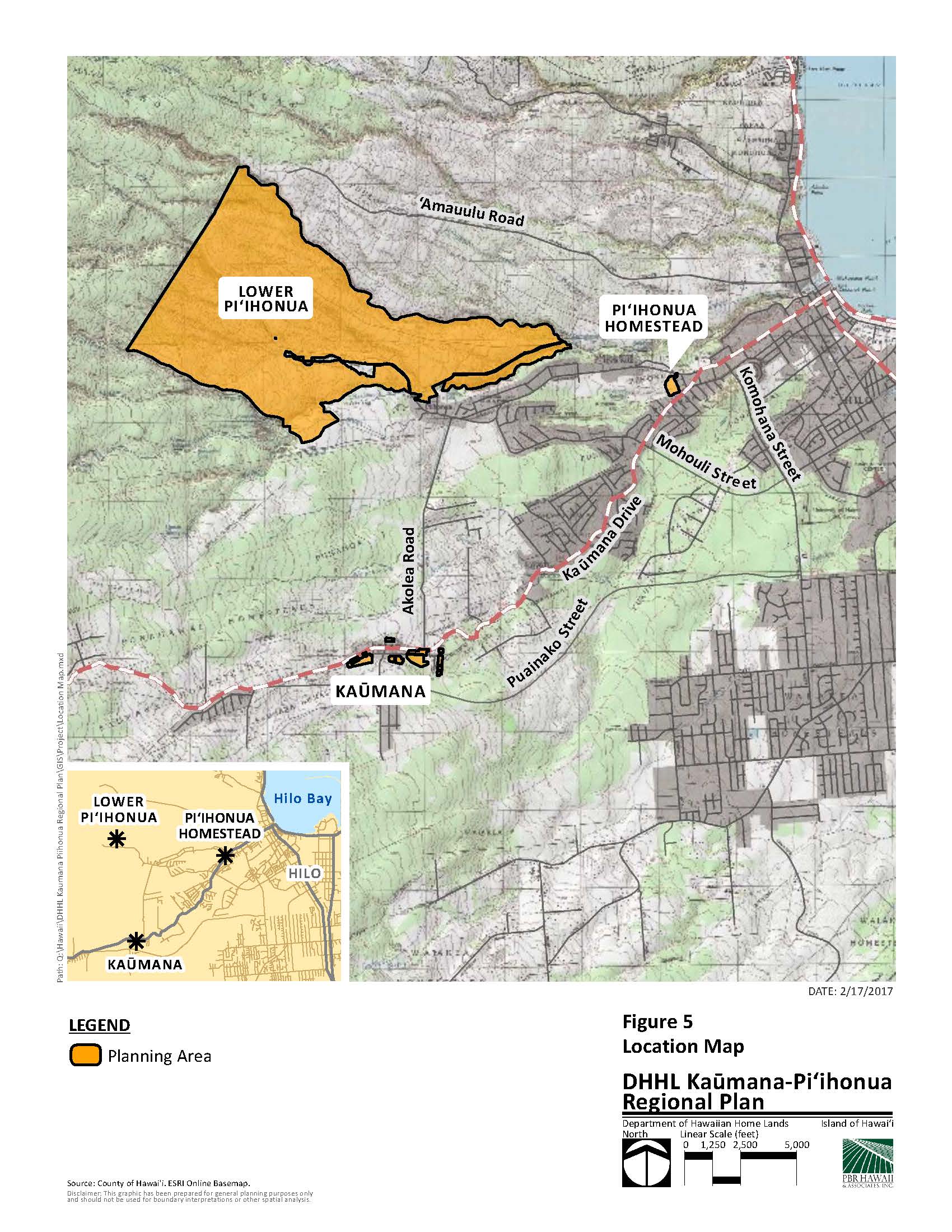
The Department of Hawaiian Home Lands (DHHL) hired PBR HAWAII to update the Kaūmana-Pi‘ihonua Regional Plan. The Kaūmana-Pi‘ihonua Planning Area is located in the South Hilo District, Island and County of Hawai‘i and spans approximately 1,900 acres. DHHL uses the regional plans to identify potential community projects and create partnerships within the communities.
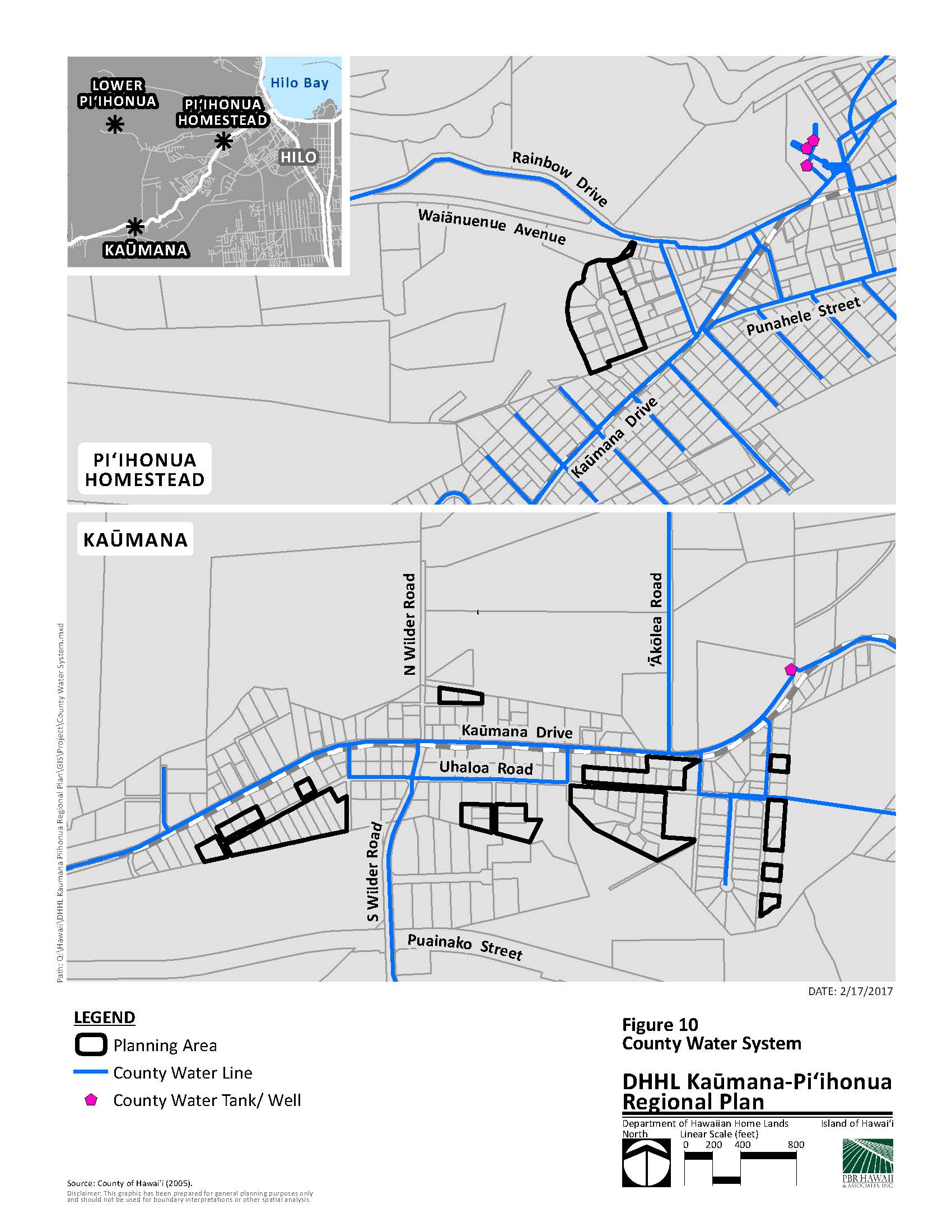
PBR HAWAII is responsible for: 1) compiling DHHL’s total land inventory in the Kaūmana-Pi‘ihonua areas; 2) crafting a community vision; 3) compiling a list of key government and community stakeholders; 4) collecting and analyzing demographic information specific to Kaūmana and Pi‘ihonua; 5) studying regional development trends to determine potential partnerships; 6) collecting information on roads, water, sewer, power, and public facilities; and 7) gathering community input to prepare a prioritized list of potential projects.
The planning process conducted by PBR HAWAII enabled the community to engage in meaningful discussion regarding key projects within the homestead, identify potential partners, and focus efforts on retaining funding from the legislature and other sources.